
Sitting at the side of a major A-road between Stafford and Newport is an unassuming little piece of wood with some amazing potential for adventuring. Loynton Moss is little more than a few trees from the roadside, but what is hidden within is a beautiful landscape with canal links offering great potential for dog walkers and ramblers alike. Plus, with the canal so close by you can absolutely turn this quick stroll amongst the trees into a grand day out exploring some of the beauty that is the Staffordshire countryside. It may only be a little patch on the map, but it's a wonderful spot all the same...
Loynton Moss is an excellent quick stop for anyone passing through the area, its car park is immediately off of the A519 a short drive outside of Newport - this dirt and gravel parking area has enough room for a handful of cars, but as this is a quiet walking spot it should rarely have more than a few in it. Despite it being a little car park outside of town its public transportation links are a little limited, or if you fancy a longer stroll then you are a 3-mile canal walk from the town of Gnosall. Busses run to the nearby town of Woodseaves but that still leaves you about a mile away from the start of today's walk - hardly an insurmountable distance, but something to bear in mind if you are planning to visit here.


Your walk today is a circular route and you can go either route from Loynton Moss car park - we opted to head straight towards the canals by heading parallel to the road, passing through a couple of gates and entering the woods. The woodland here is nice and lively, our visit in spring saw the flowers starting to pop up and plenty of birdsong with the occasional squirrel to keep us company. It won't be long before you are overlooking the canal, there is a somewhat precarious route down here but don't bother trying to get down yet, there is a much easier route further on. Follow the upper walkway enjoying the views over the canal on your right and occasional glimpses of another open area on your right; if the opportunity presents itself you may be able to pass through the bushes and trees to look out over the centre wetlands, an expanse of reeds and boggy land that we will circle around to shortly. For now, enjoy your stroll through the trees, passing by the knotted roots and splashes of life from the little flowers dotted around - our visit saw patches of snowdrops but there is also bluebells later in the season to add some colour to your journey.
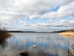
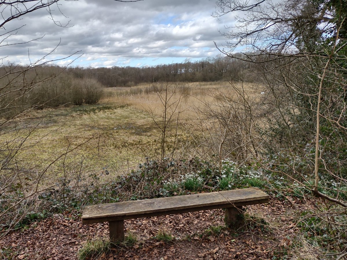
The woods will eventually join a bridge over the canal, this gives an excellent vantage point to soak in the serenity of the waterways as well as a path that can give you access to the towpaths. People looking to connect to longer walks will probably want to explore here as the canals give some great opportunities for adventures. Whether or not you do want to stay in Loynton Moss or continue onwards, you should first rejoin the path and check out the area at the edge of the wetlands - with a little information board and a bench you can unwind, take a load off and listen to the wind gently rustling through the reeds.

So the centre of Loynton Moss is what piqued my interest when browsing the map, but what exactly are you looking at? The area is known as a reedbed fen - 100 years ago this would have been a lake, but the water has been replaced by a process called natural succession as vegetation has rotted away to form a peat bed up to 7 meters deep. The fen itself is a fascinating natural occurrence, in essence, the reeds and other vegetation are floating over the water rather than being strictly rooted to the former lake-bed and the watersoaked and mineral-rich soils keep them healthy. The reeds would have once been harvested for thatching and bedding, but as there isn't much demand these days so now the area is managed by the Staffordshire Wildlife Trust to maintain the natural balance and prevent the area from completely drying out. The area can attract all kinds of beautiful wildlife and is a great opportunity for birdwatchers to spot reed bunting and curlew, but it is the insects that really benefit from this landscape - maybe not as exciting but equally important to the natural balance, although in summer when the mosquitos show up it may not be the most pleasant place to explore!
The return journey on our circular walk couldn't be easier - follow the path either through the gate or via the woodlands from your rest stop at the edge of the reedbed; passing through the gate is the easier and smoother option, but the woodlands maybe a little more picturesque so select the option that sounds more preferable to you. After a little walk both routes will link up to a farmer's track that runs along the edge of the woods before joining an open field - this is the field you crossed at the start of the walk and you should be able to see the car park directly in front of you.

That just about wraps up Loynton Moss - a great little stop off that can slot into a greater adventure or become the base of a grand stroll down the canals. For us, we started our day off at the nearby Stafford Castle before coming here, then we ended our day with a return to Aqualate Mere which is another little beauty spot well worth a stop for bird lovers. Loynton Moss was a pleasant surprise for us, we considered it a 5 minute stop, mostly because I was curious what the central area would look like, but it ended up being a charming space well worth your time - especially if you have a four-legged friend or are already local. If for nothing else, this is a great area to just be alone in nature, a little hidden gem to soak up peace and quiet.