
Looking at a map of the Shropshire Hills you may have noticed a bit of an oddity in its shape, a strange appendage stretching outwards towards Telford. It is at the Northern tip of this Area of Outstanding Natural Beauty (AONB), where you will find the Wrekin - a prominent hill standing mostly alone amongst patchwork farmland stretching out for miles around. This hill is the go-to walk for locals and it is easy to see why, with beautiful woodlands and stunning views in a convenient to reach location.
Just a short drive from the M54 at Junction 7, this place has ample parking with overflow onto the roads on busier days. If you cannot fit along the roadside near the entrance to the walking route, nor on the car park, you can always continue down the road and pull in at one of the many lay-bys - just make sure you do not obstruct any entrances and leave plenty of room for other drivers. You enter the walk here, immediately immersed in a gorgeous woodland as you start along the trail and the gradient begins.

The path will twist and turn as you ascend along the main route, with varying surfaces that are often muddy in all but peak summer. but even in the worst of conditions with a bit of forward planning, you can circumnavigate the worst mud patches. Follow the main route up the hill, the path will gently curve around the flanks until a sharp-hairpin takes you past the halfway house cafe (or stopping in if you fancy a little something). In this area, there are a few extra routes diverging away from the main path, so if you have more time after the initial climb you can always do a little exploring later.
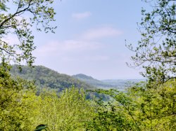
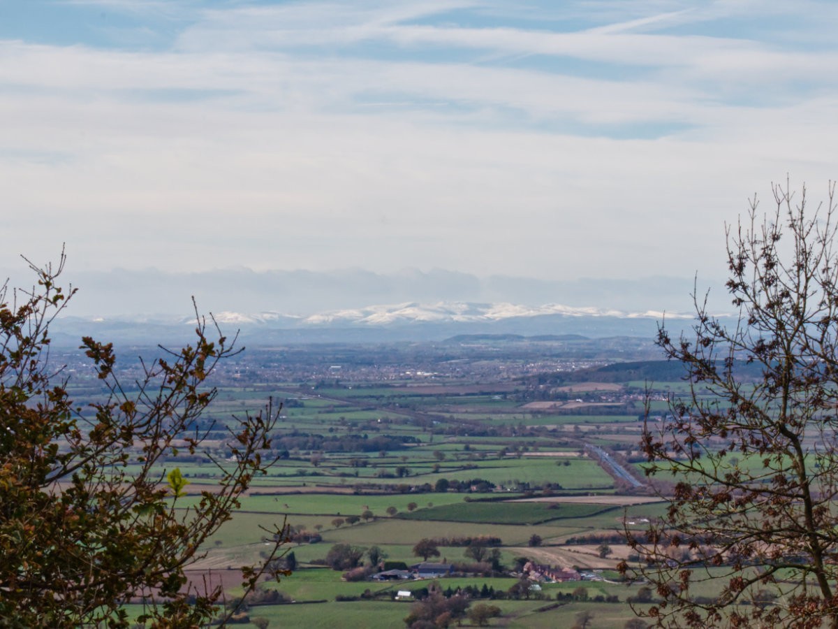
From this point forwards you will be on a more-or-less straight path, that undulates between flat and moderately steep inclines - hopefully, you won't find any of this to be a dealbreaker, but this stretch can be tough on the ankles if you are unprepared. The paths up here are well maintained and you shouldn't expect to have to deal with much mud from here on out unless you decide to venture off into the surrounding patches of woodland. Each time the ground evens out you will be greeted by more and more dramatic views on either side which you should absolutely make the most of but the top will, of course, be the greatest reward. One of my favourite things about this walk is the trees offer such good coverage from the elements that this can be a nice and comfortable walk even on particularly windy days or offer a little bit of shelter from surprise showers.
There is an information board partway up this section, telling you all about the Iron Age hillfort that used to occupy the Wrekin. If you are looking for motivation then keep an eye out for the radio tower, an instantly recognisable structure to anyone who travels the M54 frequently, as this also means you are just moments away from the top. Push on past the tower and you will soon be at the toposcope and trig point. The top of the Wrekin is the most open section, with the trees you had been wondering through giving way to that scenary you have worked so hard to reach; on the clearest of days, you can see so many distant landmarks including the Long Mynd and even all the way to Wales with the Black Mountains and the Brecon Beacons lining the horizon. The toposcope will give you a good idea of what you are looking at and if you go at the right time of year you might even get snow-capped peaks blurring the lines between ground and sky.

If you've had your fill of walking for the day you can simply retrace your footsteps back down and enjoy a steady return journey, but if you fancy a little more you can extend this journey out by continuing up and over the Wrekin. The opposite side is a steeper and more challenging walk, comprised of tree roots jutting up out the ground, you really need to tread carefully and take your time. This part is straight forward, just keep making your way down and use the various trees and roots to keep you from building up too much speed! Once at the bottom, take a left to start on the trail back to the car park or pick one of the other routes to explore; the majority of the trails here are interconnected so it is difficult to get lost, but they are also well documented on OS maps so take the app or a physical map and go off adventuring without the risk of getting lost! You can continue to circle all around the Wrekin to your heart's content or make your way out into the idyllic Shropshire countryside.
That about covers the Wrekin, a glorious little walk that for a moderate challenge offers stunning views over Shropshire and beyond. If you happen to find yourself in the area and are looking to do a little walking, this is a great spot that is convenient and rewarding. The area is well equipped beyond that too, urban options are plentiful as you are right on the doorstep of Telford and not too far from Shrewsbury. If you want to go for a day's shopping before getting your fill of the great outdoors the two can be combined here easily! Plus, if you fancy venturing into more green spaces all you need do is follow the Shropshire Hills south-west and plenty of beautiful options await - I thoroughly recommend checking out Carding Mill Valley.