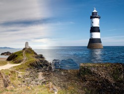

Pretty much all of the furthest rocky outreaches of Anglesey are marked by some kind of lighthouse, originally made to help guide the ships heading around the jagged cliffs and underwater hazards that litter the coastline. Today's point of interest marks the north-eastern entrance of the Menai Strait at Penmon Point and is protected by the charming black and white striped Trwyn Du Lighthouse. This rugged stretch of coast has plenty of things to see and when combined with the medieval priory on the entrance lane there is a little bit of something for everyone here - either you can wander the beaches, spend some time fishing at the point while enjoying the sound of waves gently lapping the rocks, explore the many rock pools or check out the priory for a bit of religious history. This is one of those places that can be enjoyed as a quick stop as part of a greater day out or be turned into a full day out all by itself.
To reach Penmon Point you will need to take the single coastal road that leads out to the car park - this is most easily reached by leaving the B5109 north from Beaumaris and following the signs for Penmon. We took this turning here which leads onto easy and wide roads with only short narrow sections, this road will take you all the way down to the point. The road will snake around through the country for a while before turning towards the Menai Strait and getting you right up close to the water's edge - this area gives you a spectacular vantage point back over to the mainland and there are plenty of laybys to stop in and admire the views. The road once again moves inland slightly and narrows to more of a country lane, but passing points are aplenty and this is only a short run to the first stop at the priory. The priory marks the entrance to Penmon Point and there may be an attendant on the gate collecting admission - this will cover both the cost of exploring the priory and heading out to the point itself. There is parking here directly outside the priory and you are welcome to stop and explore now or on the return journey back from the point. The rest of the lane is a narrow country lane but there are ample passing points and long straights so visibility is easy - once you run out of road the lighthouse should be well in view, so find a parking space and let your adventure begin. Public transport may be a little tricky but still doable with routes running to the nearby Ty Gwyn bus stop from places such as Bangor, this will still leave you with that long coastal road to walk. You may be able to consult OS maps to find some corner-cutting opportunities, but if you stick to the road then you should expect a 2-mile walk from the bus stop to the point itself, but at least it is in some sensational scenary!

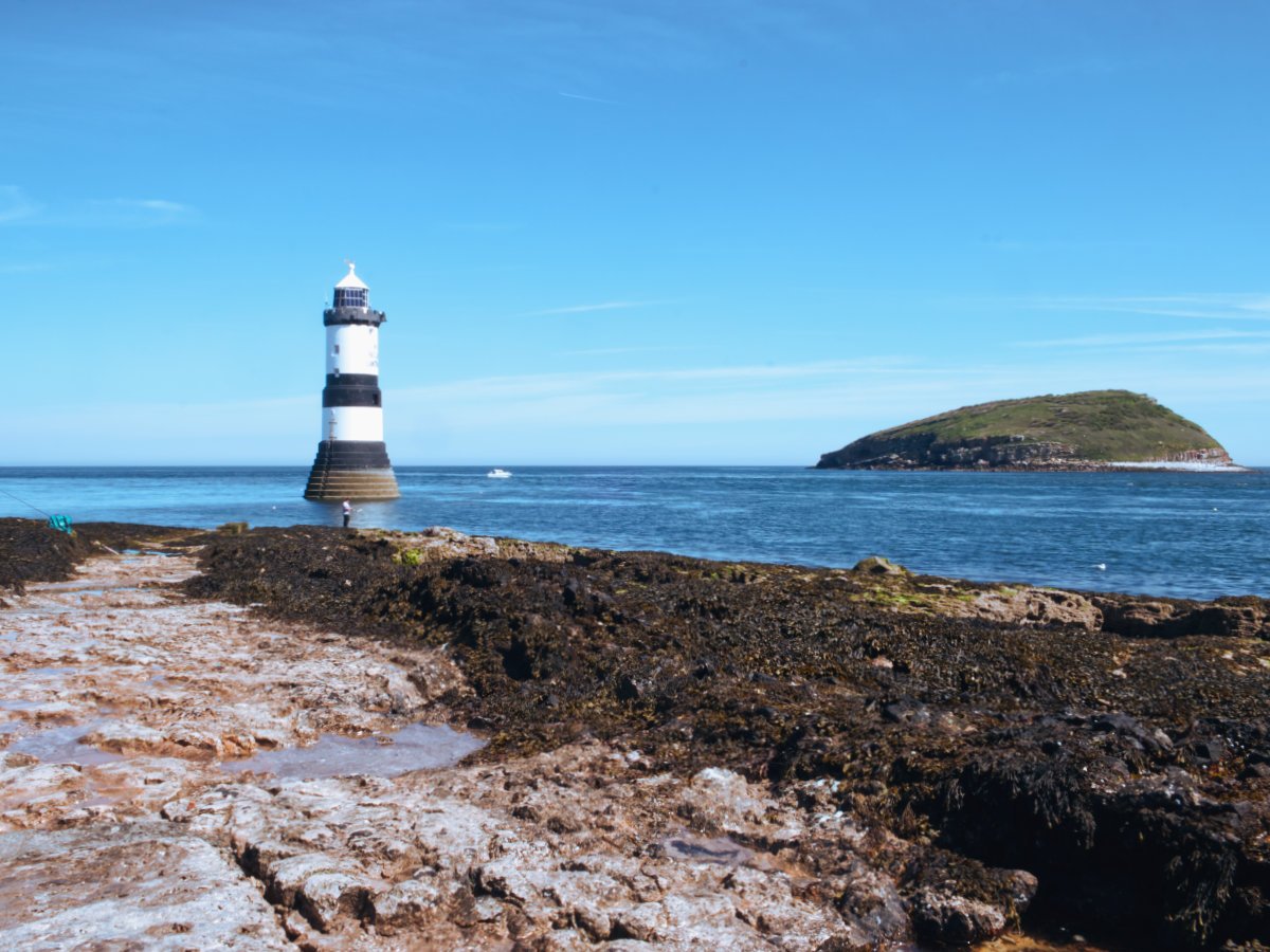
Immediately adjacent to the parking area at Penmon Point is the Pilot House café, so if you are in need of refreshments or wish to use the facilities you can make a pit stop here. Otherwise, head out towards the lighthouse where you will find the path down to the loose stone beach and onto the black rocks. There are no wrong routes here, pretty much every path will give you a new vantage point out over all the attractions here. You'd struggle to miss Penmon's Trwyn Du Lighthouse in front of you, but just behind it is the equally prominent bulbous island sticking out the water - this is Ynys Seiriol, but it is perhaps more commonly known as Puffin Island. This Special Protection Area is home to one of the largest Cormorant colonies in the British Isles, as well as guillemot, razorbill, shag, kittiwake and, of course, Atlantic puffins. But this area isn't just known for its birds and even during our short time at the point we got to enjoy porpoise jumping and dancing in the sunshine - this seems like a great spot for any wildlife lover to spend some time and do some spotting.
The lighthouse itself spends almost all of its time well out to sea, only really reconnecting at peak low tide (depending on the height of the tide, of course). The lighthouse has stood in this spot since the early 1800s, in response to the difficulty navigating into the Strait and beyond - in fact, the steamer "Rothsay Castle" ran aground at the nearby Lavan Sands resulting in 130 people losing their lives just a few years prior to the construction of the lighthouse. It had been designed specifically to reduce the impact that the force of the water would have upon it during storms, the stepped-base helping to disseminate the sheer force of storm surges. It spent the first part of its life as a traditional manned lighthouse, by 1922 it was modernised to an unmanned acetylene operation (replacing its original oil-burning lamp) and by 1996 the lighthouse was converted to run mostly on solar power. There is also a fog horn on sight, originally a bell that rung out with the lappings of the waves, this was somewhat controversially converted to an electronic horn in 2019 - possibly subtracting from some of the lighthouse's charm but almost certainly making it far more effective at its job. This is a stunning building that practically glows in the sunlight and can make for some awe-inspiring photos.

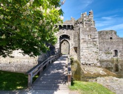
For those looking for an extended adventure, there are paths all around the tops of the cliffs and a few stretches of accessible beach to stretch your legs along. Alternatively, you should absolutely take some time to explore the priory if you didn't on the way in. Priody Seiriol Sant, or St Seiriol's Priory Church, started out as St Seiriol's monastery - a wooden structure constructed sometime in the 10th century but destroyed by 971. This would then be replaced by a stone building sometime in the 12th century, this new monastery survived Norman Invasion and would be expanded in the 13th and 16th centuries. Llywelyn the Great, King of Gwynedd, and his successors made the monastery wealthy and granted it land - it thrived until it would be undone during the Dissolution of the Monasteries in 1536, where Henry VIII disbanded all monasteries and took their income/assets. The church which had formed the centrepiece of the monastery survived however and continues to operate as an active church to this day. A walk around the grounds here and the feel of history is palpable, the old haphazard gravestones crammed into the eerily silent surroundings is a beautiful experience. Plus, beyond the old monastery, there is also the Dovecot, a building used to house pigeons for their eggs and meat constructed sometime in the 17th century, and St Seiriol's Well, a common sight at Celtic churches these wells are believed to hold mystic powers but this particular well is most likely the oldest building at Penmon and possibly the oldest still standing Christian building in Wales.
Penmon Point is a great little stop off for all the lovers of nature and landscapes, from the spectacular views across the Menai Straits and back towards Snowdonia to all of the wonderful wildlife occupying Puffin Island and the waters that surround it - this whole area was made for picnicking with a set of binoculars to see what you can spot! We spent some time exploring the area before continuing onto our road trip that spanned the width of Anglesey, with Ynys Llanddwyn's spectacular lighthouses as the end goal. Even if you don't plan to travel that far then you should absolutely make a stop off in Beaumaris to see its wonderful castle - a contender for one of the prettiest in Wales. If you are willing to drive further then you could always stop off at the National Trust's Plas Newydd or drive all the way up to Holy Island to see another staggering lighthouse: South Stack. Or pick a spot somewhere comfy near the point and while away the day, grab a bite to eat from the cafe and have an amble along the coastal walks - you won't be bored at Penmon Point.