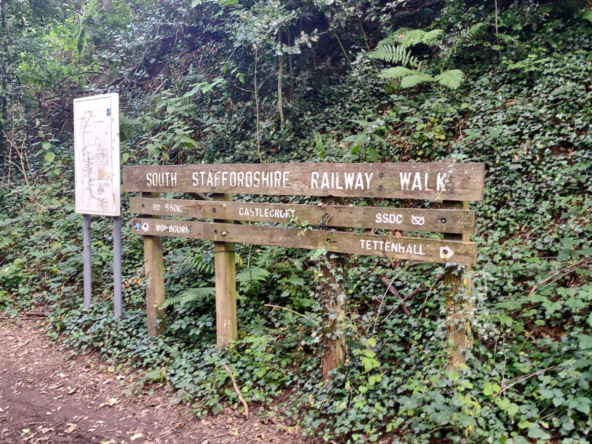

If you find yourself in the suburban sprawl of Wolverhampton and want to escape to a small piece of nature then you're in luck, the South Staffordshire railway walk is an amazing opportunity to enjoy some green spaces and even make your way on to much longer walks. This is a glorious little strip of land that forms a roughly 6-mile nature reserve full of life and makes it easy to escape out to the patches of the country surrounding western Wolverhampton. As the name would suggest, this strip of nature bisecting the cul-de-sacs of the city outskirts is a former railway line so don your walking boots, or jump on a bicycle, and see where this great pedestrian highway will take you.
Making your way to the South Staffordshire railway walk isn't quite as simple as some of our other spots - you can join it practically anywhere it passes by! With little walkways and gulleys splintering away from the walk, you can join the walkway from Aldersley, Tettenhall, Wightwick, Lower Penn, Wombourne and just about everywhere in between. Beyond Wombourne, you technically leave the South Staffordshire railway walk to join the Kingswinford Railway walk but these routes naturally connect and form one long route that makes more sense to be discussed together. If you fancy walking the full route then there are two options for you: either start from Aldersley Stadium, near the entrance following the blue signs for cycle route 81 or make a short walk from Himley Hall. My preference is to join the walk from Aldersley Stadium because that way I can combine it with the spectacular canals in the area too. Of course, as the railway's course used to run straight through the suburbs of Wolverhampton there are plenty of public transportation options that can bring you to this walk.

Before you embark on this walk, we will take a brief look at the history of the route. Admittedly, the life of this section of the Wombourne branch was short-lived; the line was created sometime between 1912 and 1925 by the Great Western Railway Company, but passenger services had been withdrawn by 1932. By the second world war, it saw a small resurgence in usage, primarily to transport wounded soldiers following the Normandy beach landings of D-Day to the hospitals in the area. Post-war saw the railways nationalised and the line became part of the Western Region of British Railways where the line continued operation until the mid-1960s. It would be the Beeching cuts, a plan to increase the financial efficiency of the nationalised rail system, that would end the life of the Wombourne branch, and on June 24th, 1965 the line would see its last train.
Now on to the walk: for the most part, railway walks often have the same features - gentle gradients, smooth curves and easy travelling. Considering you are right in the city it can feel like you've fully escaped to the country here, with dense trees and plentiful wildlife to keep you company as you ramble. I was constantly greeted by foraging squirrels and birds darting amongst the trees, and at so many spots along the route you can explore away from the main paths - signs mark interesting spots and local landmarks to escape to in case you are in the mood to mix it up a bit. The surfaces change frequently, with the old rail line moving from perfect pathways throughout most of the route to more muddy and unkept paths out towards Wombourne. Beyond the natural beauties are some amazing remnants of both the old line and our industrial heritage, with plenty of amazing old bridges to see and canals to explore. If you fancy stopping for something to eat you are in luck! There are two cafés right on the old line itself, occupying the old train stations - one is Tettenhall railway station, currently operating as 'Cupcake Lane', and the other is 'The Railway Cafe' on the north edge of Wombourne.
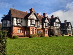
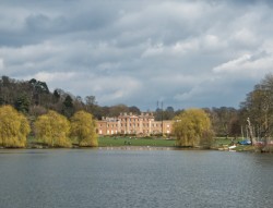
So you are out on the walking route, but where else could you end up? I ended my route by visiting Himley Hall (and of course, Baggeridge Park beyond) but that isn't the only option. The walking route travels through Castlecroft where you could break away via Smestow Valley Nature Park to visit the wonderful Wightwick Manor or join the canals for a little variety. The Aldersley end of the walk also lets you out near the canals too, with the Staffordshire and Worcestershire Canal only a short walk across the stadium car park; the canals to the north of Wolverhampton can connect you through to the countryside beyond with great spots such as Pendeford Mill Nature Reserve not too far away. Depending on how far you are willing to walk, there are so many possibilities to find!

Next time you are looking for adventure in the city I hope you consider this retired railway line for your next walk. Not only does it have plenty of charm and things to see by itself but the opportunities to explore beyond its limits make this an amazing day out. I love to grab my bike and explore the line from end to end, taking each of the little avenues that break away from the paths to see where I end up. The utility of this walk also makes it shine, it offers such a smooth and direct route between places that even if you aren't much of a walker you could still potentially integrate this into your commute - making your daily excursions a little more green, even when stuck in the city...