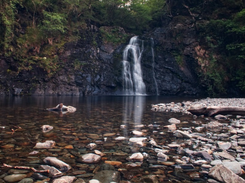
In the Vale of Ffestinog lies the Ceunant Llennyrch National Nature Reserve, a relatively hidden green expanse stretching from Trawsfynydd Lake to the River Dwyryd. Through the centre runs the Afon Prysor and it's on this river that today's attraction can be found: Rhaeadr Du. One of Snowdonia's lesser travelled falls, this little slice of heaven can be reached with very little sweat and tears.
The starting point for the walk can be reached from either the A487 (Eastbound from Porthmadog) turning in at Maentwrog, or the A470 (Southbound from Blaenau Ffestiniog or Northbound from Trawsfynydd). you are aiming for a small car park located at 52°56'03.8"N 3°59'20.4"W. The road up may have several closed gates along the way, but if you jump out to open them you should have no issues getting there.
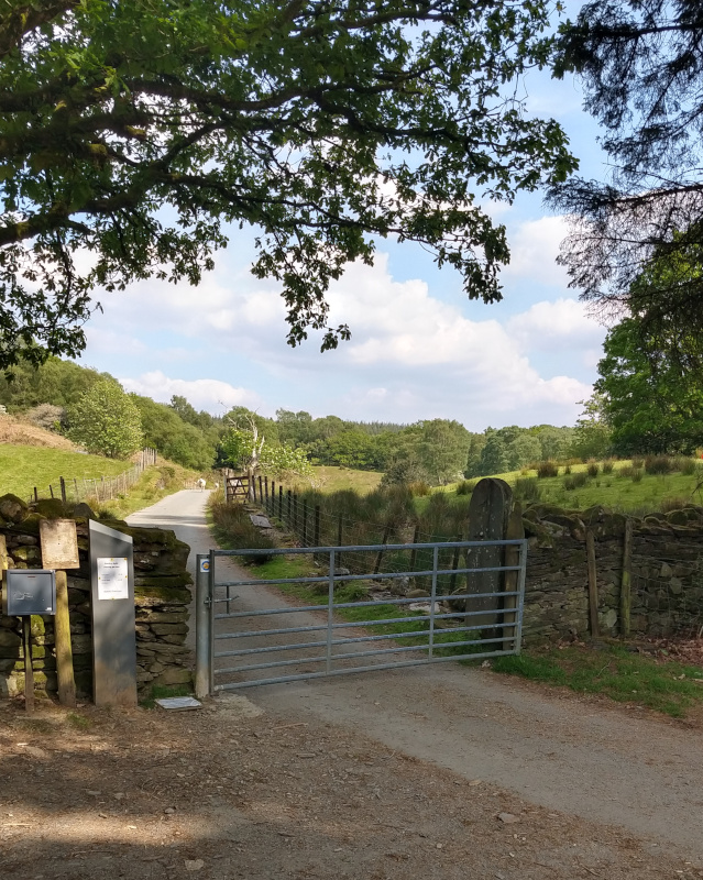
Once at the car park, head towards the gate that marks the entrance to some farmland - on our visit these fields and the lanes were both full of sheep so take care on the drive up and try not to give any little lambs a scare. There's a small 'honesty-box' for parking at the gate, so make the necessary payment and head onwards.
After you've gone through the gate, head down the road between the 2 farmers fields for about 100 meters until you arrive at a kissing gate on your right.
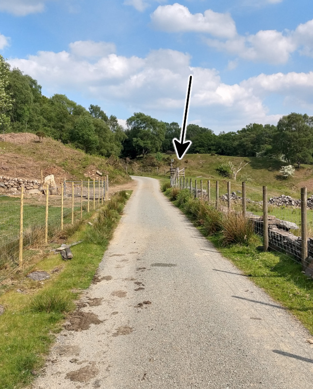
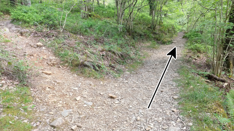
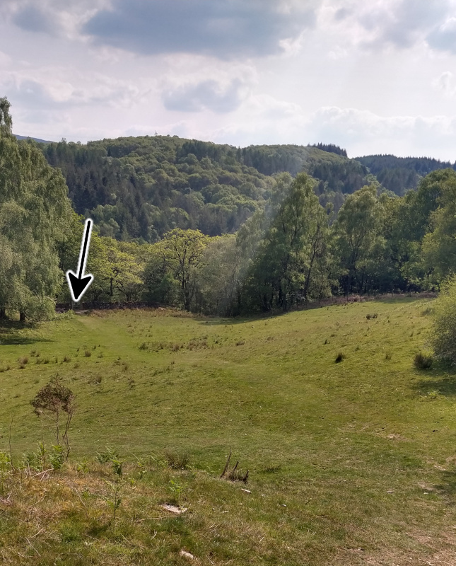
After you go through the kissing gate you will be on a grassy hill, you'll be able to see 2 faint paths, keep to the right path as you head down the hill. The paths aren't the clearest, but you should be able to see your destination right at the bottom of the hill (See photo below).
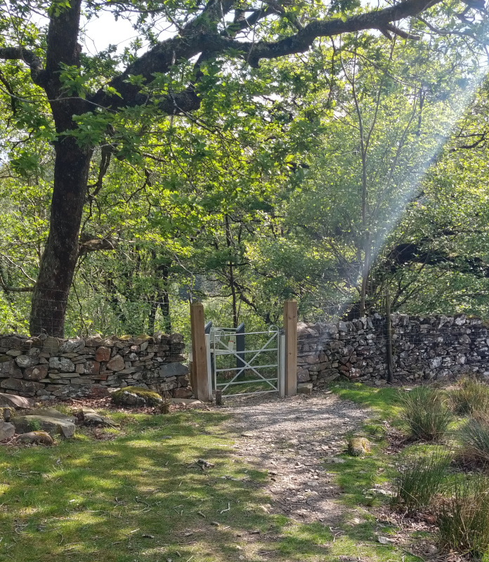
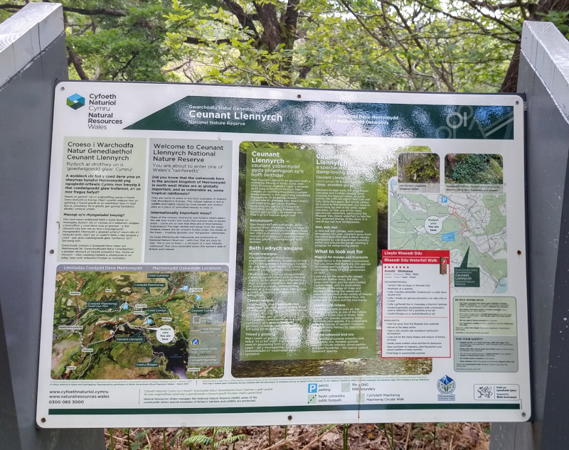
Once you go through this gate, you will immediately see a sign detailing the walk through Ceunant Llennyrch so it should be pretty straight forward from here. There is a circular walk you can do however we only went as far as the waterfall, as this was what interested us the most. The entire circular walk estimates 1.5 hours to complete (which is probably generous if you're an experienced hiker/walker).
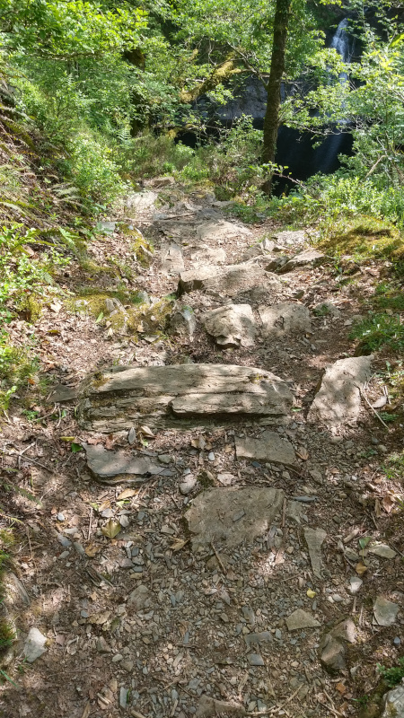
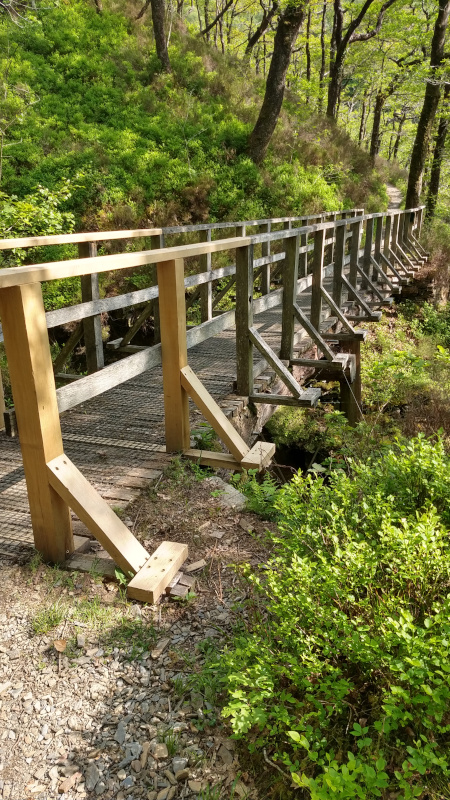
Follow the path down into the forest, keep to the left, the path will continue to get lower and lower heading upstream, continue until you reach a wooden bridge made out of an old, large tree trunk. After you've crossed this bridge you will come to a fork in the path where you will want to keep to the right path. You should be able to see the plunge pool of the waterfall down to your right and the sound of the water should be getting louder at this point!
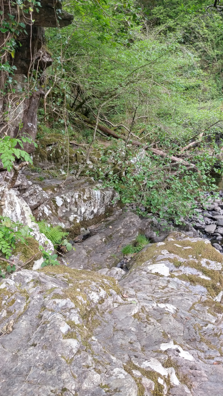
Eventually the path will give way to some stairs and you should be able to peep the waterfall through the trees too, climb down via these stairs onto the stones and pebbles of the waterfall area and you have arrived!
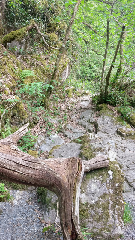
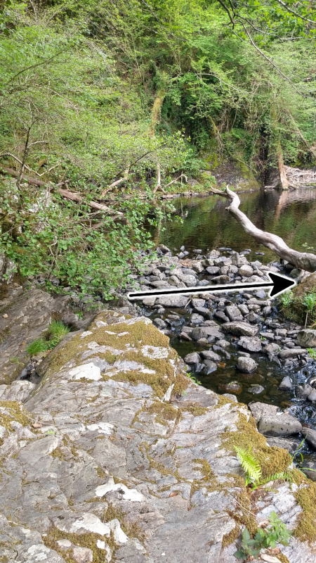
As you'll see at the bottom of the stairs the waterfall itself is surrounded by a deep plunge pool, making access difficult, but there are places to stand to get a closer look. You could wade across the river directly in front of you to get across to an island of pebbles which you're able to stand on and get a good look. If you don't fancy getting your feet wet, here's the safest way to the pebble island rather than having to wade across the river: At the bottom of the stairs, follow the left hand cliff face and continue until you can see some large boulders to the left.
Climb over the boulders at the cliff face and then step over the large stones in font of you to the right, sticking out enough to get across the water. There should be a large log in the water mid-way across which was stable enough to lean on to make the last stretch to the pebbles.
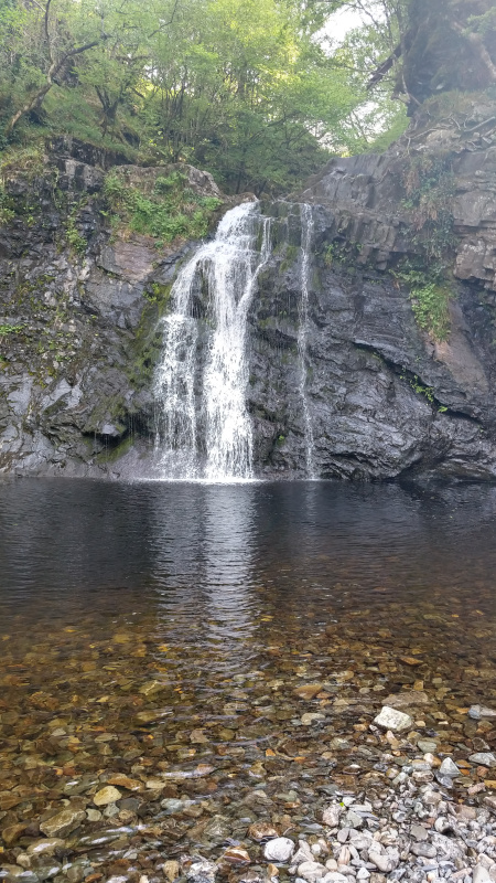
Once you have crossed the water you can enjoy the stunning waterfall- if you're lucky you will have it all to yourself :)
Hopefully you enjoy this random find as much as we did and fingers crossed our directions make sense!! It was such a beautiful, peaceful place, many great photo opportunities and the walk itself was not difficult. We did bump into some cliff climbers whilst we were there, so if that takes your fancy then this is a good place to do so. If Kayaking is more your speed, you should check out some of the Lower Prysor Kayak videos on YouTube and consider this spot for your next outing. I would definitely go back again, especially either in the height of summer or even in the snow as the surroundings were stunning.
As a final little warning, please be aware that the area is prone to flash floods due to a dam further up the river, so be careful if taking any young children/animals with you as you never know what could happen and do not stand too close to the water bed.