Barmouth Bridge

Post Banner
Help

At a glance

Key stats

Difficulty icon Difficulty: Beginner
Distance icon Distance: 5.6 miles
Route icon Show Route

This is a point-to-point route, so the distance assumes you will retrace your footsteps

Brief Overview

Smooth paths and mostly flat with only very short sections of inclines/declines. The route shown is point-to-point from the outskirts of Barmouth to the outskirts of Fairbourne.

Getting There

There is no dedicated parking, navigation will take you to Barmouth town. Both long and short-stay parking available around the town.

Navigation

Navigate to: Barmouth, Gwynedd, LL42 1NF
Latitude/Longitude: 52.720667, -4.053943

Help


Difficulty

Difficulty Icon

A rough estimate of difficulty, this does not factor in distance and is only based on the conditions of the route followed. A 20 mile walk on paved roads will be marked as beginner, whereas a 1 mile scramble up a mountain will be Advanced/Expert. Please consider both distance and difficulty when choosing a walk.

Beginner

Clearly marked routes that are easy going with smooth surfaces, little to no inclines or declines. Should be accessible to all.

Intermediate

May include some minor sections of uphill or downhill that could be a little challenging. Some surfaces may be loose or otherwise be difficult to pass. The vast majority of people should be able to tackle this walk, but good hiking shoes are absolutely recommended.

Advanced

Walks may be almost completely comprised of difficult terrain, be it up/downhill or difficult surfaces that are slippery or muddy. Some may struggle on this walk, hiking shoes and possibly hiking sticks are a must.

Expert

A very difficult walk, may require scrambling or climbing in parts. Appropriate preparation should be made before attempting these walks, as they may require additional equipment. These are very much for experienced walkers only and it may be worth having a guide who knows the area with you.


Length

Length Icon

A rounded estimation for the distance of the route shown, remember to factor in the return journey! Obviously, circular routes will end with you where you started, but any point-to-point walks have been doubled assuming you are going to retrace your footsteps. If the articles includes any suggestions for extra walks they will not be included in this value.


Route

Length Icon

The map displays a downloadable .GPX file that can be used in Satellite Navigation devices or apps. Walks shown will typically be the simplest route described in the article. Routes are for reference only, always remain on paths and be aware of your surroundings.


Navigation

We offer links to either copy or navigate to the destination, the navigate link should work on most modern platforms (If all else fails you can manually copy the text above the buttons!). It is recommended you use Latitude/Longitude rather than address whenever possible as it will be much more accurate and consistent across different navigation tools, but we understand that sometimes address is the only supported option so we include that too where applicable. Unfortunately, if your destination is in the middle of the countryside you may struggle to navigate by address.


Features

Paid admission Paid admission
Honesty box toll
Dogs welcome Dogs welcome
24-7 access 24-7 access

Local weather

High
Low
Wind Speed
Wind Speed
Sunrise/Sunset
Sunrise
Sunset
High
Low
Wind Speed
Wind Speed
Sunrise/Sunset
Sunrise
Sunset
High
Low
Wind Speed
Wind Speed
Sunrise/Sunset
Sunrise
Sunset
High
Low
Wind Speed
Wind Speed
Sunrise/Sunset
Sunrise
Sunset
High
Low
Wind Speed
Wind Speed
Sunrise/Sunset
Sunrise
Sunset

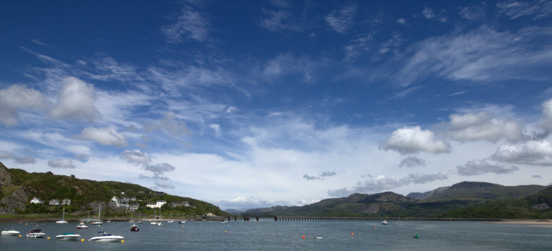
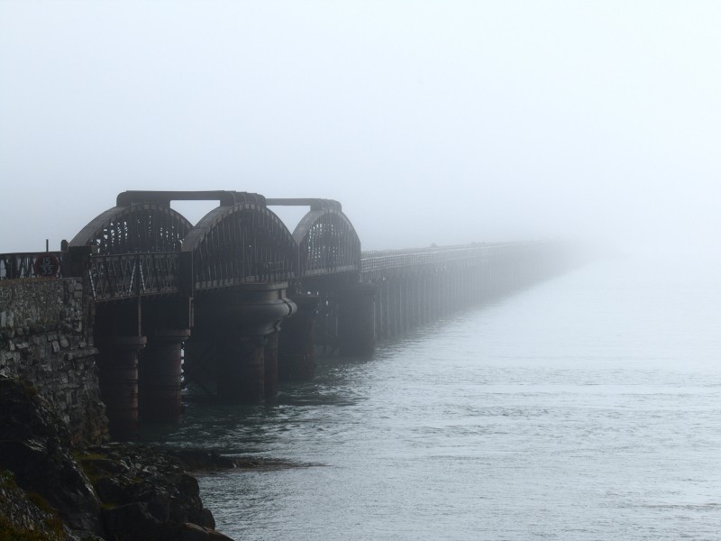
Barmouth bridge stands as one of the most recognisable sights in the town - the bridge marks the arrival of inland tourists as they finish snaking their way up the Mawddach river and arrive at its mouth. For many this old rail bridge marks the beginning of holidays and good times to come, but surprisingly not many people take the time to explore the bridge. It first opened in the 1860's and has been an active train line more or less constantly ever since, surviving two world wars, multiple closure threats and has since earned its Grade II* Listed status. The bridge's distinct twin arches actually can facilitate the passage of ships, with the first of the arches (closest the Barmouth side) rotating on it's central support - unfortunately this feature is not used any-more, but would be an amazing thing to see. A footpath allows pedestrian and bicycle access with a small honesty toll for crossing and I will run you through getting to the bridge and what you can expect to see.

Barmouth Bridge arches


Reaching the bridge is unfortunately a little challenging from the Barmouth side, it currently lacks any dedicated walkways and the road you will need to cross is littered with blind-spots. In its current form I would not regard the bridge as being particularly disability friendly from the Barmouth side and I would take great caution with getting young children and dogs to cross the road. The organisation Barmouth - Viaduct Access Group have been pushing for safer and easier access, you can view their progress on their website and sign up for updates.

From Barmouth

In order to reach the bridge, follow the main-road out of Barmouth past The Last Inn and up the hill - the road only has a walkway on one side and unfortunately this is the opposite side to where we need to be. The entrance to the bridge is both signposted and easy to spot but it sits on the outer edge of a fairly blind corner (See map reference: 52°43'12.0"N 4°02'49.1"W): with two people acting as spotters you can cross fairly safely but even then you're still taking your life into your hands. Thankfully the speed limit in this area is low and the roads make it difficult for drivers to speed but regardless do take extra caution when crossing here. A second possibly preferable option, is to cross the road into a small walk area before the bridge; as you approach the bridge entrance there are two large stones on the opposite side of the road, between these is a small entrance at a point where it is slightly easier to cross (Street View Reference), cut through here and you will come out about 10 yards up from the bridge entrance - you will unfortunately have to walk up the roadside if you take this option but it is probably a safer considering the alternative. Once you have made it across there is a surprisingly steep slope down to the bridge itself and if you follow the paths down to the left you can get onto a nice little soft-sand beach with beautiful views of both the bridge and Barmouth Harbour.

From Fairbourne

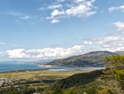
The Fairbourne approach is a longer walk but much simpler - all you need do is find your way onto the footpaths that run alongside the estuary (one example entrance is here towards the beach car-park but more entrances may be littered around the town) and follow it inland until you reach a pedestrian rail crossing. After safely crossing the railway head north, away from the platform, to reach the bridge. If needed, public toilets are available by heading in the opposite direction after the railway crossing, past the platform.


Underside of bridge

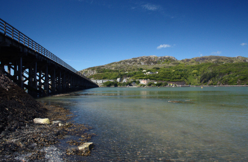
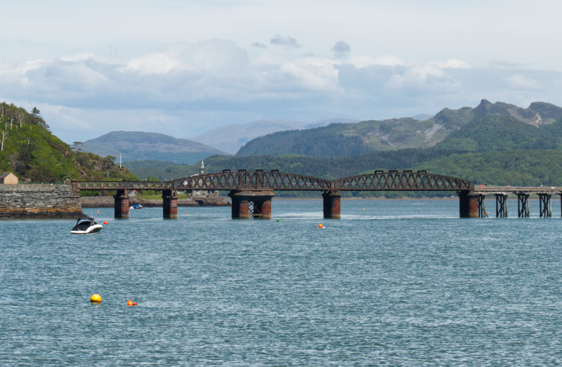
So now that you have arrived your exploration can begin, the bridge offers spectacular views in every direction and it is definitely worth planning your walk so you experience them at both low and high tide. At the Fairbourne side you can access the underside of the bridge by passing over a turnstile and following the beach underneath; at low tide you can explore a great distance around the bridge but you'll need appropriate footwear and to keep an eye on the tide. The boards that make up the walkway occasionally have gaps and may move underfoot so if you have any issues with water or heights it is probably best not to look down. Finally, a couple of warnings: the bridge is very exposed so make sure you have appropriate clothing for the weather and take it steady in strong winds. Secondly, a train may pass while you are crossing and it may be both loud and fairly shaky on the bridge, so just hold onto the handrail, keep a close eye on dogs and children, and wait for the train to pass.

Bridge from Barmouth Beach

Once you're done exploring the bridge you have plenty of options for adventures beyond the obvious towns and beaches nearby. On the Fairbourne side, you could head on to Arthog to see the falls there and even carry on up the hills to see the stunning Cregennan Lakes. On the Barmouth side, you could head up Dinas Oleu to see the Frenchman (See National Trusts information here), The walks around both sides of the estuary have options that could take you for miles and miles so get your boots on and get exploring!


Related Content

Views above Barmouth - Dinas Oleu Views above Barmouth - Dinas Oleu
Beer, Burgers and Barmouth Beer, Burgers and Barmouth

Always stay up to date

Never miss a post! Click the button to get notified on your device whenever new content goes live.

When you click the button your browser may display a prompt to display notifications, if this doesn't display you may have already disabled notifications.

We will never spam you, and only ever push notifications when we have something for you!

Turn on Notifications
Success
Something went wrong
Notifications enabled!
Something went wrong - your browser may be blocking notifications.